Live Cams
Countries
Featured Cams
Get A Cam
Live Cams
Countries
Featured Cams
Get A Cam
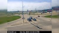
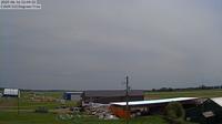
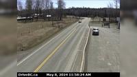
Mackenzie: Airport NE | Live Webcams
Webcam & Weather Report
See.cam
North America
CA
British Columbia
Mackenzie
Mackenzie: Airport NE
Current Still
Timelapse
Daylight Still
Webcam was last updated 1 years ago
Rating
Webcam Views
Map
Discuss
See more webcams in
British Columbia
Fort St. John › South: Hwy 97 at 100<sup>th</sup> Ave in - looking south
Area A › South-East
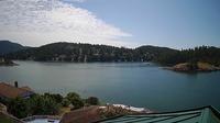
Area B › North: Hwy 19, 31 km north of Campbell River, looking north
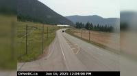
Falkland › South-East: Hwy 97 at Silvernails Road near - looking southeast
Vanderhoof › East: Vanderhoof Airport (CAU4)
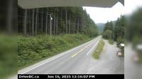
Smithers › South-East: Hwy 16 at the Trout Creek bridge, looking south-east
Abbotsford › East: Hwy 1 at Vedder Canal Bridge, looking eastbound
Gibsons › North-East: Hwy 101, top of - Bypass at Stewart Rd, looking east
Interlakes › East: Hwy 24, 63 km west of Little Fort, looking east
Pitt Meadows › North: Hwy 7 (Lougheed Hwy) at Dewdney Trunk Rd, looking north
Peace River Regional District › South: Hwy 97 at Beaton Highway, 44 km north of Fort St. John, looking south
Interlakes › West: Hwy 24, 63 km west of Little Fort, looking west
Explore by Continent
Europe
Asia
South America
Oceania
North America
Africa


Discuss