Live Cams
Countries
Featured Cams
Get A Cam
Live Cams
Countries
Featured Cams
Get A Cam
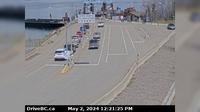
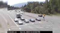
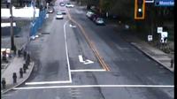
Saanich › North: Hwy 17 (Patricia Bay Highway) at Ravine Way, looking north | Live Webcams
Webcam & Weather Report
See.cam
North America
CA
British Columbia
Saanich
Saanich › North: Hwy 17 (Patricia Bay Highway) at Ravine Way, looking north
Current Still
Timelapse
Daylight Still
Webcam was last updated 1 years ago
Rating
Webcam Views
Map
Discuss
See more webcams in
British Columbia
Area A › South-West
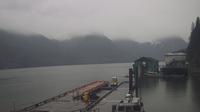
Grassy Plains › West: Hwy 35 at Francois Lake Southbank Ferry Landing looking north at ferry ramp
Courtenay › East: Intersection of Ryan Rd and Lerwick Rd in - looking east
Area D › North
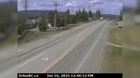
Burns Lake › West: Hwy 16, in - at N. Francois Hwy, looking west
Lantzville › South: Hwy 19, at Aulds Rd in Nanaimo, looking south
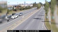
Surrey › North-West: Hwy 15 at Fraser Hwy (1A) looking north-west
Invermere › West: On Toby Creek Road at Panorama Fire Hall, near Springs Creek Rd, looking west
Langford › East: Hwy 1 at Millstream Interchange, looking east
West Vancouver › North: North end of Lions Gate Bridge, looking north
Township of Langley › South: Hwy 1 eastbound on-ramp from 232nd St, looking south
Richmond › North
Explore by Continent
Europe
Asia
South America
Oceania
North America
Africa


Discuss