Live Cams
Countries
Featured Cams
Get A Cam
Live Cams
Countries
Featured Cams
Get A Cam
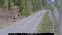
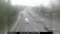
Dawson Creek › North: Hwy 97 at Dangerous Goods Route, west of - looking north | Live Webcams
Webcam & Weather Report
See.cam
North America
CA
British Columbia
Dawson Creek
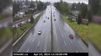
Dawson Creek › North: Hwy 97 at Dangerous Goods Route, west of - looking north
Current Still
Timelapse
Daylight Still
Webcam was last updated 2 years ago
Rating
Webcam Views
Map
Discuss
See more webcams in
British Columbia
District of North Vancouver › East: Hwy 1 (Upper Levels Highway) at Westview Dr. looking east
Area H › North: Hwy 19 at Cook Creek Road, about 29 km north of Parksville, looking north
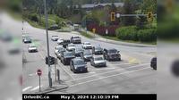
Delta › South: Hwy 17 at 52nd Street, looking south
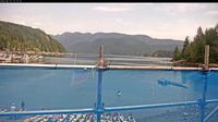
District of North Vancouver › North-West: Deep Cove
Bridal Falls › East: Hwy 28, (Gold River Hwy), at Crest Lake, about 14 km east of Gold River, looking east
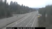
Columbia-Shuswap Regional District › West: , Hwy , by Griffin Lake, about km west of Revelstoke, looking west
Columbia-Shuswap Regional District › West: , Hwy , about km west of Revelstoke, looking west
Area B
Saanich › North: Patricia Bay Hwy (Hwy 17) at Sayward Rd in - looking north
District of North Vancouver › South: Hwy 1, north end of Ironworkers Memorial Bridge, looking south
Salmon Valley › North: Hwy 97, north of Prince George at - Rd, looking north
Langford › West: Hwy 14, between - and Sooke near Suyer Rd, looking west
Explore by Continent
Europe
Asia
South America
Oceania
North America
Africa


Discuss