Live Cams
Countries
Featured Cams
Get A Cam
Live Cams
Countries
Featured Cams
Get A Cam
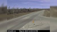
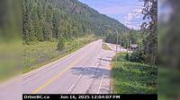
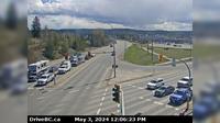
Pitt Meadows › South-East: Hwy 7 (Lougheed Hwy) at Kennedy Road, looking southeast | Live Webcams
Webcam & Weather Report
See.cam
North America
CA
British Columbia
Pitt Meadows
Pitt Meadows › South-East: Hwy 7 (Lougheed Hwy) at Kennedy Road, looking southeast
Current Still
Timelapse
Daylight Still
Webcam was last updated 1 years ago
Rating
Webcam Views
Map
Discuss
See more webcams in
British Columbia
Peace River Regional District › North: , Hwy at Beaton Highway, km north of Fort St. John, looking north
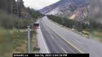
Area I › West: Hwy 1, about 6 km east of Lytton Airport, looking west
Kent › North: Hwy 9, north end of Agassiz-Rosedale Bridge, looking north
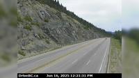
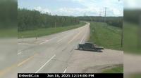
Thompson-Nicola Regional District › South: Hwy 5, approximately 40 km north of Blue River, looking south
Fraser Valley Regional District › North: , Hwy , about km north of Zopkios Brake Check, looking north
Area A › North-West: Klinaklini Glacier
Avola › North: Hwy 5, about 15 km south of - looking north
Dawson Creek › East: Hwy 97 (John Hart Hwy) at Mason Rd/237 Rd, looking east
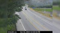
Courtenay › South: Hwy 19A at Ryan Road in - looking southbound
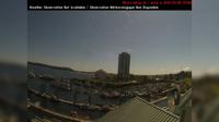
Nanaimo › South-East: NanaimoHarbour
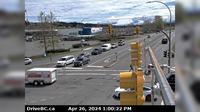
Prince George › East: Hwy 97 at Hwy 16 in - looking southbound on Hwy
Area F › West: Hwy 18, mid-point between Hwy 1 turn-off and Cowichan Lake exit, looking west
Explore by Continent
Europe
Asia
South America
Oceania
North America
Africa


Discuss