Live Cams
Countries
Featured Cams
Get A Cam
Live Cams
Countries
Featured Cams
Get A Cam
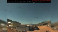
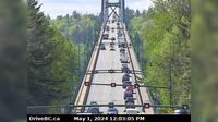
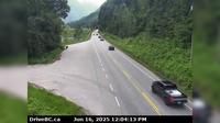
North Vancouver › South: Hwy 1 (Upper Levels Highway) at Lonsdale Ave, looking south | Live Webcams
Webcam & Weather Report
See.cam
North America
CA
British Columbia
North Vancouver
North Vancouver › South: Hwy 1 (Upper Levels Highway) at Lonsdale Ave, looking south
Current Still
Timelapse
Daylight Still
Webcam was last updated 1 years ago
Rating
Webcam Views
Map
Discuss
See more webcams in
British Columbia
Vernon › South-West
Fort St. James › South: Hwy 27 at Hill St/Greenview in - looking south
Kaslo › North: Hwy 31 at Hwy 31A Junction in - looking north
Pemberton › West: Hwy 99 at Portage Rd in - looking west
District of North Vancouver › South: North end of Lions Gate Bridge, looking south
Telkwa › East: Hwy 16, in - at Hankin Rd, looking east
West Vancouver: Crazy Raven Bar and Grill
Castlegar
Area D
Columbia-Shuswap Regional District › East: , Hwy , about km west of Revelstoke, looking east
Saanich › West: Hwy 17 northbound at - Rd, looking west
Prince George › West: Hwy 16 at Vance Rd in - looking westbound
Explore by Continent
Europe
Asia
South America
Oceania
North America
Africa


Discuss