Live Cams
Countries
Featured Cams
Get A Cam
Live Cams
Countries
Featured Cams
Get A Cam
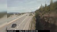
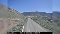
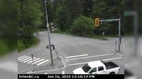
Moyie › North: Hwy 3, near the south end of - Lake, looking north | Live Webcams
Webcam & Weather Report
See.cam
North America
CA
British Columbia
Moyie
Moyie › North: Hwy 3, near the south end of - Lake, looking north
Current Still
Timelapse
Daylight Still
Webcam was last updated 1 years ago
Rating
Webcam Views
Map
Discuss
See more webcams in
British Columbia
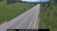
Armstrong › North: Hwy 97A at Larkin Cross Rd, about 14km north of Vernon, looking north
Fort Nelson › South
Port Alberni: Harbor Quay
Sooke › East: Hwy 14 at Glinz Lake Road, looking east
British Columbia › West: Calvert Island West Beach
Spences Bridge › North: Hwy 1, on the west side of the Thompson River at the north end of - looking north
Area A › West
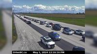
Delta › East: Hwy 17 at 56<sup>th</sup> St., looking east
Area A
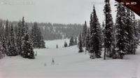
Alpine Meadows › East: Hwy 99 at Alpine Way, looking east
Area B › North-East: Hwy 5, about 18 km northeast of Vavenby, looking northbound
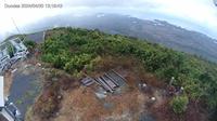
British Columbia: Hecate Island
Explore by Continent
Europe
Asia
South America
Oceania
North America
Africa


Discuss