Live Cams
Countries
Featured Cams
Get A Cam
Live Cams
Countries
Featured Cams
Get A Cam
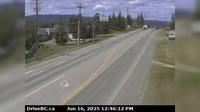
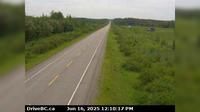
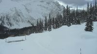
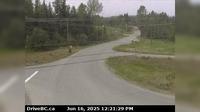
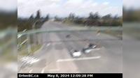
Peace River Regional District › North: , Hwy , about km south of the Sikanni River Bridge and about km north of Fort St. John, looking north | Live Webcams
Webcam & Weather Report
See.cam
North America
CA
British Columbia
Mason Creek
Peace River Regional District › North: , Hwy , about km south of the Sikanni River Bridge and about km north of Fort St. John, looking north
Current Still
Timelapse
Daylight Still
Webcam was last updated 5 years ago
Rating
Webcam Views
Map
Discuss
See more webcams in
British Columbia
Burns Lake › West: Hwy 16, in - at N. Francois Hwy, looking west
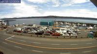
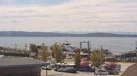
Campbell River: Ferry Cam
Harrison Hot Springs › West: Hwy 1 at Herrling Island overpass westbound, looking west
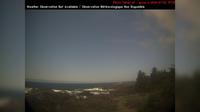
Ucluelet › West: AmphitritePointLighthouse
City of Langley › East: Hwy 10 at 200 Street in Langley, looking east
Fraser Lake › North: Hwy 16, at Nautley Road, looking north
Powell River › West
Isle Pierre › West: Hwy 16 at Dahl Lake Rd, about 33 km west of Prince George, looking west
Area D › South-West
Quesnel › West: Hwy 97, at Sales Rd, about 10 km south of - looking west
Delta › South: Hwy 17A, at Hwy 10 (Ladner Trunk Rd), looking south
Area A
Explore by Continent
Europe
Asia
South America
Oceania
North America
Africa


Discuss