Live Cams
Countries
Featured Cams
Get A Cam
Live Cams
Countries
Featured Cams
Get A Cam
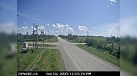
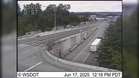
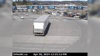
Juan de Fuca Electoral Area › East: Hwy 14 near Cormorant Way/Trailhead Dr, looking east | Live Webcams
Webcam & Weather Report
See.cam
North America
CA
British Columbia
Juan de Fuca Electoral Area
Juan de Fuca Electoral Area › East: Hwy 14 near Cormorant Way/Trailhead Dr, looking east
Current Still
Timelapse
Daylight Still
Webcam was last updated 1 years ago
Rating
Webcam Views
Map
Discuss
See more webcams in
British Columbia
Cecil Lake › East: Road at 243rd Rd, looking east
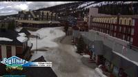
District of North Vancouver: Cliff - Big White
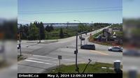
Delta › South: 80th Street at Ladner Trunk Rd, looking south
Beachview
Wright › North: Hwy 97, 37 km south of Williams Lake, looking north
Surrey: SR 543 at MP 0.8: D St
Quesnel: Airport W
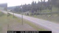
Area A › East: Hwy 1, about 3.7 km south of Bamberton, looking east
Area H › North: Hwy 19 at Cook Creek Road, about 29 km north of Parksville, looking north
Area C › South
Nanaimo › North: Hwy 1 at Zorkin Rd/Brechin Rd, looking at Departure Bay Ferry Terminal
Nanaimo Waterfront Suites & Marina
Explore by Continent
Europe
Asia
South America
Oceania
North America
Africa


Discuss