Live Cams
Countries
Featured Cams
Get A Cam
Live Cams
Countries
Featured Cams
Get A Cam
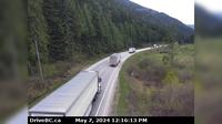
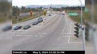
Cherryville › West: Hwy 6, 83 km east of Vernon, looking westbound | Live Webcams
Webcam & Weather Report
See.cam
North America
CA
British Columbia
Cherryville
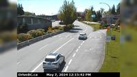
Cherryville › West: Hwy 6, 83 km east of Vernon, looking westbound
Current Still
Timelapse
Daylight Still
Webcam was last updated 1 years ago
Rating
Webcam Views
Map
Discuss
See more webcams in
British Columbia
Columbia-Shuswap Regional District › West: , Hwy , about km west of Revelstoke, looking west
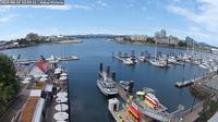
Victoria: Victoria Harbour
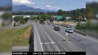
Chilliwack › North: Evans Road overpass at Hwy 1 near - looking north
Kent › East: Hwy 7 at Hwy 9 (Evergreen Drive) in Agassiz, looking east
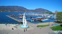
Kelowna: Sails and downtown pier
Atlin › South
Surrey › South: Hwy 99 near - USA border, looking south
Area C
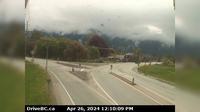
Chetwynd › West: Hwy 97 at Wabi Estates Road, east of - looking west
Delta › East: Hwy 17 (South Fraser Perimeter Rd) at 80th Street, looking east
Lytton › North-West
Langford › South: Hwy 1 at West Shore Parkway, looking southbound towards Victoria
Explore by Continent
Europe
Asia
South America
Oceania
North America
Africa


Discuss