Live Cams
Countries
Featured Cams
Get A Cam
Live Cams
Countries
Featured Cams
Get A Cam
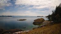
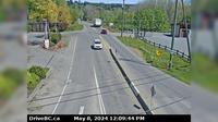
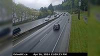
Area C › North: Hwy 27, about 12km south of Fort St. James at Spencer Pit, looking north | Live Webcams
Webcam & Weather Report
See.cam
North America
CA
British Columbia
Area C
Area C › North: Hwy 27, about 12km south of Fort St. James at Spencer Pit, looking north
Current Still
Timelapse
Daylight Still
Webcam was last updated 1 years ago
Rating
Webcam Views
Map
Discuss
See more webcams in
British Columbia
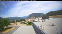
Heriot Bay: Quadra Weather Station
Castlegar › North
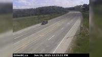
Peace River Regional District › East: Hwy , km west of BC/Alberta border, looking east
Lantzville › North: Hwy 19, at Aulds Rd in Nanaimo, looking north
Nanoose Bay › East: Hwy 19 at Northwest Bay Rd, near - looking east
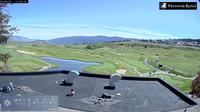
Vernon › East: Predator Ridge Resort
West Kelowna › West: Hwy 97 at Hwy 97C junction, about 5 km south of Westbank, looking west
Chilliwack › West: Hwy 1 at Evans Road overpass near - looking west
Area E › South: Hwy 19 at the Nanoose Rest Area, looking south
Cache Creek › East: Hwy 1 at Collins Rd, looking east on Hwy 1/97
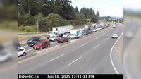
Surrey › West: Hwy 10 at 152 Street, looking west on Hwy
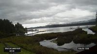
Area D › East: Sproat Lake Landing Resort
Explore by Continent
Europe
Asia
South America
Oceania
North America
Africa


Discuss